Using big data to reduce vegetation risk
Shane Brunker, chief technology officer at NM Group, discusses the importance of vegetation management and how it can be used to improve network operators' storm resilience.
8th October 2019 by Networks
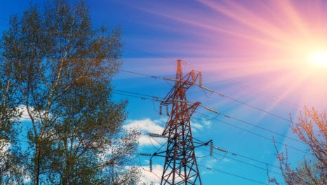
With winter fast approaching, the risk of power outages due to storm activity escalates. To help meet this challenge, NM Group have launched a big data vegetation modelling service, to predict where future tree falls are likely to occur.
The aim being for networks to be able to use predictive analysis to put better protections in place. Developed as part of a joint research project with Durham University, this new service is called Vegetation Analytics.
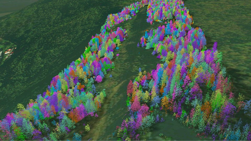
For most distribution networks with a large exposure to vegetation, the number of potential fall-in hazards might number tens or even hundreds of thousands of trees
In order to mitigate against storm-related tree failure, networks need to precisely identify and remove or manage trees with the potential to strike overhead lines. Current inspection technology can highlight trees in close proximity to powerlines. Yet for most distribution networks with a large exposure to vegetation, the number of potential fall-in hazards might number tens or even hundreds of thousands of trees. Clearly, when the number of possible threats is unmanageably high there is a pressing need for data-driven decision making to prioritise finite resources.
Vegetation Analytics is a data service that processes vast amounts of data to understand trends and predict future vegetation threats. It does this through the inclusion of both historic data and current network information.
Because of the data volumes involved, machine learning processes are used to rapidly assess variables which have the potential to cause or influence tree fall. The analysis shows which factors have a strong positive correlation with historic tree strikes on a specific network.
Variables include tree type and forest structure, topography, soil type and drainage, historic weather and existing tree management records. Previous testing on utility networks has shown an accuracy of up to 80 per cent in the predictive ability of this modelling technique.
Once a localised predictive model has been established, the system applies this to a virtual 3D replica of the entire utility forest. Additional techniques can further improve the model’s predictive capabilities. For example, fall risk can be combined with modelled tree fall direction and the degree of overstrike to aid in refining inspection and removal planning. As a result networks can ensure they proactively manage these locations in a prioritised manner.
By looking at the data more holistically, it allows operators to more effectively plan against storms and optimise OPEX spend for future years
Geospatial inspection techniques, such as LiDAR, are already being used successfully by UK DNOs for identifying vegetation threats. Nonetheless, one of the limitations of the existing business-as-usual approach is that it only considers a single snapshot in time to assess network risks. Historical information can also tell you a lot about what happened and why, and aid in making new, accurate predictions for the future. By looking at the data more holistically, it allows operators to more effectively plan against storms and optimise OPEX spend for future years.
For more information on Vegetation Analytics visit www.nmgroup.com
Comments
Login on register to comment
Related content
Power
The future for vegetation management
Why networks should focus on data not trees to overcome the costly challenges involved in vegetation management
Power
An unprecedented opportunity for change
Why short interruptions will matter in RIIO-ED2 and how to address them.

Power
Time for less talk and more action on decarbonisation
Core "oven-ready" solutions to decarbonising heat and transport exist today and should be implemented without delay, says WPD's future power networks expert.
Related supplier content

Power
Load patterns and lockdown: how Covid-19 is impacting electricity networks
Insights into dynamics on the low voltage network as the outbreak unfolds
Downloads
Protect electrical equipment from insulation failure
Insulation faults are a major cause leading to the eventual failure of electrical equipment. Partial discharge (PD) is a very reliable indicator of developing insulation faults. Regular PD testing allows users to detect and analyze PD activity

Heat
How E.ON. is helping the City of London become a zero emissions city
Discover Citigen. Deep in the heart of our bustling capital